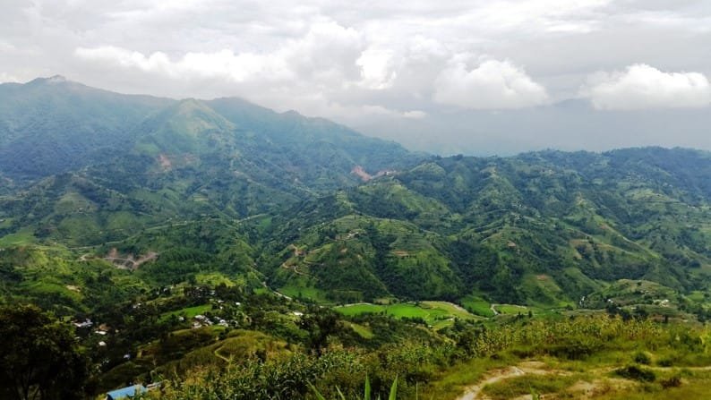
Kakani is a rural municipality (Gaunpalika) and former village development committee in Nuwakot District in Bagmati Province of central Nepal. It is formed by combining six village development committees, Okharpauwa, Chauthe, Kakani, Madanpur, Chaturale, and Thansing from the past.

At the time of the 2021 Nepal census, the Kakani rural municipality administered a population of 24,504 living in 6,312 individual households. Location, Latitude 270 N and Longitude 820 E with altitude above 2000 meters. Kakani is situated in the northwest of Kathmandu, about 15-45 km from the city. Kakani is linked with Kathmandu City by Pasang Lamu Highway.
At the time of the 2021 Nepal census, Nuwakot District had a population of 263,391. Of these, 54.6% spoke Nepali, 39.9% Tamang, 2.0% Newari , and 0.9% Lepcha as their first language.
38.2% of the population in the district spoke Nepali as their second language. Nuwakot, being a hilly area with few leveled grounds, most areas are still undeveloped. In the last few years, huge changes have been seen. The city areas are provided with schools, colleges, and hospitals and the road infrastructure is also developed. Two hydropower stations are currently in operation. People are dependent on agriculture, teaching, foreign economy, livestock farming, business, hotels, Agro Tourism, Eco Tourism Khadya Bank, etc.
VIN has been working in Okharpauwa, wards 1 and 2 of Kakani rural municipality since 2015 immediately after the earthquake. In this area, VIN’s projects are concentrated on earthquake relief and schools. Okharpauwa is affected by a landfill site in Sisdole where all the garbage from the Kathmandu district is brought. Over 90% of people are dependent on agriculture. They produce radish, potato, and seasonal vegetables which are sold on markets in Kathmandu market. People are trained to produce strawberries. Many families are engaged in trout fish farming. So, people from this area are involved in professional farming. Kagatigaun, a lower part of Okharpauwa which is home to many Balami people is deprived of development activities. They are uneducated and child marriage is still being practiced. Hygiene and sanitation practices of the area are highly compromised. About 80% of households still do not have access to toilets and clean drinking water. Schools in the area have no toilets or water supply.
Okharpauwa Village profile
| Ward name | Ward number | Location | Total Households (2021) | Total population (2021) | Male | Female | Location of ward offices | Health facility |
| Okharpauwa | 1 and 2 | 27.80N, 85.250E | 1510 | 8204 | 4075 | 4129 | Ward 1- Kagati gaun Ward-2 – KauleThana | Health post and Kathmandu Metropolis health Center |
Schools profile
| S. N. | Name of village | Public | Private | ECD | ||
| Higher Secondary | Secondary | Basic | ||||
| 1 | Okharpauwa | 0 | 3 | 5 | 1 | 9 |
| 4 | Total | 0 | 3 | 5 | 1 | 9 |

 Member of